| 1842km 6h00 |
Depart from Doughton Park campground on Blue Ridge Parkway |
|---|---|
|
Again, starting at the crack of dawn means you have the road and the sunrise to yourself. On the Blue Ridge Parkway, at altitudes above the valley clouds, there are some very rewarding vistas, especially when the sun is off on the horizon. 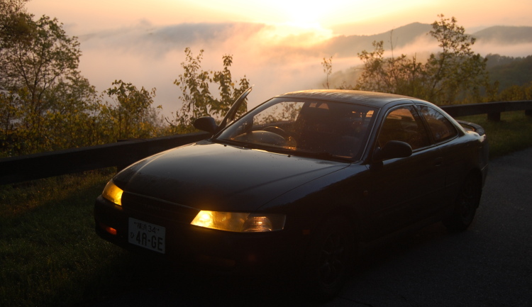 Looking eastward, its easy to see that you are in fact on a ridge. Here the foothills seem to be swimming in clouds far beneath. 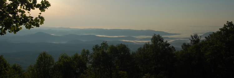 |
|
| 1954km 9h15 |
Linn Cove Viaduct |
|
The Linn Cove Viaduct represents the final section of parkway to be completed. In order to preserve the face of Grandfather Mountain, engineers had to construct a rather complicated viaduct which was the first of its kind in North America (the technology was developed in Europe). If you didn't know better, you might drive the quarter-mile span and not think twice, but a view from the overlooks and the visitor centre helps to appreciate the challenge it was to design and construct. 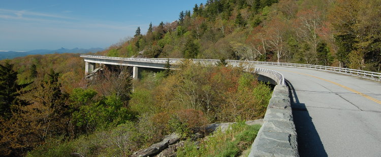 |
|
| 2043km 11h15 |
Mount Mitchell Summit (Highest peak East of the Mississippi) |
|
Leaving the Blue Ridge Parway near milepost 355, you enter Mount Mitchell State Park. An easy 8km drive takes you to a parking lot just beneath the highest peak East of the Mississippi. It's quite ironic how easily this point can be reached, but it is very much worth the small detour to park your car 2km above sea level and take a leisurely stroll to the top. 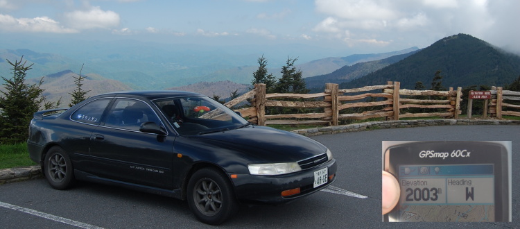 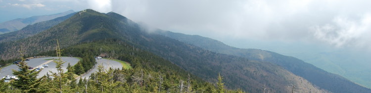 A short section of Blue Ridge Parway beyond Mount Mitchell was closed for construction. This meant having to backtrack and detour around via Asheville. It was just SO disappointing to have to drive the twisty section of road in the other direction for a few miles... I detoured on the smallest through roads I could find, which included NC 197 to the West of the parkway. The road is fast until it changes to insane switchbacks and then suddenly changes to good gravel at its peak. It was a very pleasant surprise.
|
|
| 2170km 14h30 |
Pass through Asheville, NC |
|
Asheville is the only true city in the mountains. The downtown has some stunning architecture and the Biltmore Estate is nearby. But the traffic was an unwelcome change, so I made my way back to the solitude of the parkway as quickly as I could. 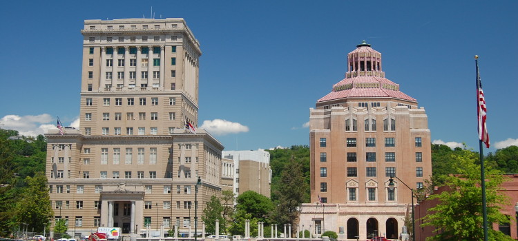 |
|
| 2180km 15h00 |
Restart Blue Ridge Parkway at junction with US 25 |
|
The parkway climbs leaving Asheville making for a very pleasant drive with lots of scenic overlooks. 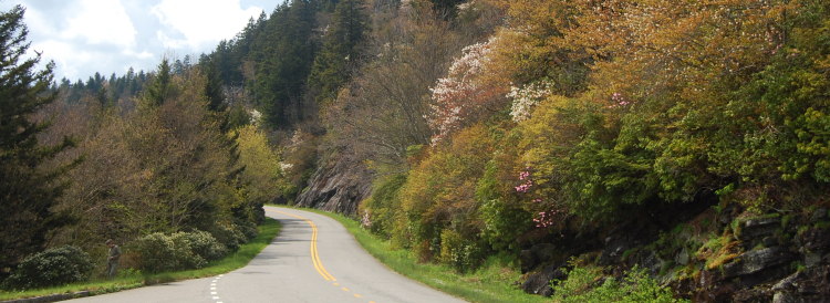 The parkway reaches its highest point after it has left the actual "Blue Ridge" and starts to head directly for the Smoky Mountains. 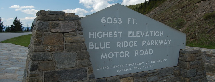 The parkway had plenty of curves and three tunnels before it completes its 750km run at the edge of Great Smoky Mountains National Park. |
|
| 2310km 18h00 |
End of Blue Ridge Parkway |
|
The Southern End of the parkway is located within the Cherokee Indian Reservation. The town of Cherokee is not far away and is a bit of a tourist trap. But heading the other direction on US 441 takes you into the Great Smoky Mountains National Park. 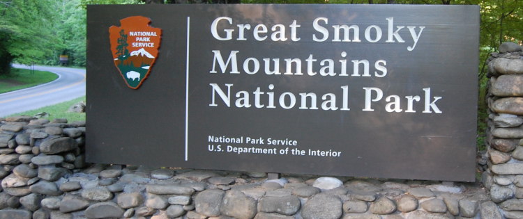 And, if you're really lucky, a herd of elk will be out grazing in the first pasture you encounter. 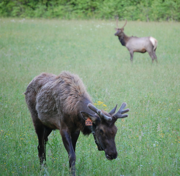 |
|
| 2324km 19h30 |
Arrive at Smokemont campground, Great Smoky Mountains NP, NC |
|
Smokemont is the first campground in the park, and like many of the other campgrounds, is a former logging camp. Driving Summary: 482km over 13.5 hours |
|