| 2669km 7h15 |
Depart from Tellico Plains, TN |
|---|---|
|
Knowing that heading West across Tennessee I'd gain an hour with the switch to Central Standard Time, I decided to sleep an extra hour. Knowing now how long it takes to drive across Tennessee on secondary roads, I might have stuck to the usual 6h00 departure. The goal for the day was to visit Jack Daniels and make good headway on the Natchez Trace. Along the way I saw something I really wasn't expecting. Again, another reason to take the road less traveled!  Completely by chance, the road I had chosen turned out to be part of the Trail of Tears: the approximate route taken by native Americans displaced from their traditional territories to Oklahoma. Moreover, the roads between Tellico Plains and Spencer had plenty of unexpected switchback sections and very fast curves. 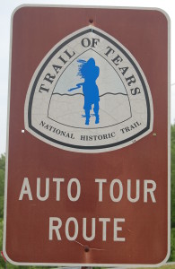
|
|
| 2930km 10h00 (CST) |
Arrive at Jack Daniels Distillery, Lynchburg, TN |
|
I certainly wouldn't call myself a JD man, even if I have the same initials and birthday. But I know plenty of people who are (including my best friend) so why not take the tour and pick up a bottle now that this dry county allows certain liquor sales at the distillery (yes, this distillery is in a dry county!). While the tour is fun, and downtown Lynchburg is quaint, you are reminded of the scale of this operation when you leave town on the back roads and see the "real" cooperage house and all the storage sheds. A nice bonus was that JD's current master taster was on hand to sign the bottle I had purchased for my friend. 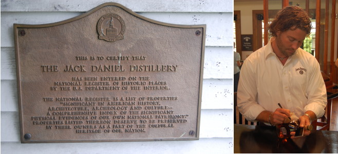 This is the route I intended to take to the Natchez Trace:
But I missed the jog right on TN 129 and ended up doing this (and I can't even blame it on the lemonade from the distillery tour):
|
|
| 3054km 14h00 |
Begin Natchez Trace (Jct. TN 96) |
|
Joining the Natchez Trace at TN 96 is great since it provides stunning views of the Natchez Trace's white double arch bridge spanning the valley. However, being a stubborn person who did not want to be told that he did not drive the entire length of the trace, I first followed it up North a few miles to its beginning on the southern far reaches of Nashville so that I could take this photograph: 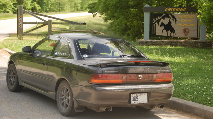 And then I retraced my steps back to the bridge which looks like this: 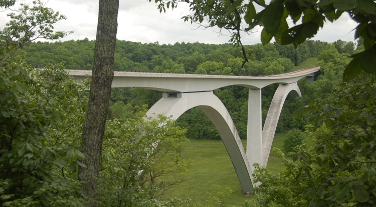 The 710km long Natchez Trace Parkway roughly follows the original Natchez Trace which connected Natchez, MS to Nashville, TN. The trace (or trail) was originally trampled down by migratory animals, then by native Americans and finally by boatsmen who floated down the Mississippi and needed to get home on foot (until steamboats finally enabled upriver travel). Wherever possible, the old trace is clearly indicated, and there are many opportunities to walk and even drive it. As with the previous parkways, you generally find yourself surrounded by nature on a nice road with lots of pullouts and things to see. The Natchez Trace is flat and less twisty, but the 80km/h speed limit partly compensates for this. Among the sights are many short trails leading to waterfalls. 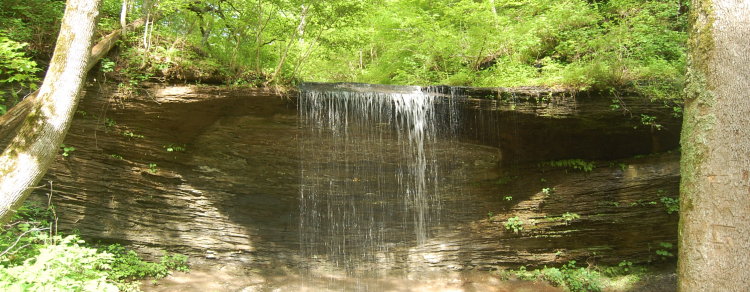 |
|
| 3234km 18h00 |
Enter Alabama |
|
The Trace only briefly runs through the Northwest corner of Alabama. Here it crosses the Tennessee river (between Tellico Plains and Lynchburg I crossed it further upstream). 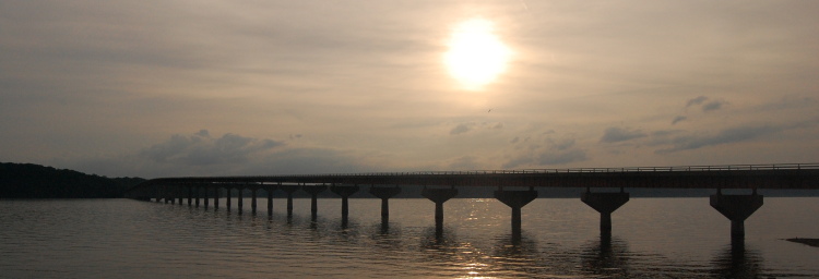 |
|
| 3290km 19h30 |
Enter Mississippi |
|
Mississippi is the final state on the southbound Trace. And its a big state as I would discover when I finished the Trace some 24 hours later. If you look to the far right in the following picture you can see a small mound which was built by native Americans. I wondered why they would build so close to the border on the Mississippi side. Are real estate taxes lower in MS and sales taxes lower in AL? 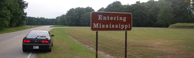 |
|
| 3300km 19h40 |
Arrive at Tishomongo State Park, MS |
|
With the sun starting to set, it was time to camp. Tishimongo's primitive campsites were reached by a red mud road which looked like it would be precarious when wet (I had My Cousin Vinny in my head). Worse, with thunder and lightning fast approaching, I inhaled my Chef Boyardee and scrambled for the tent. Would the Levin make it back out that road if it poured? It continued to thunder and lightning until I finally fell asleep in the stifling humidity. 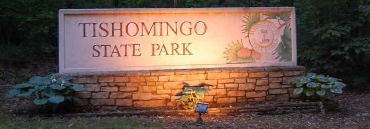 Driving Summary: 631km over about 13.5 hours |
|