| 2325km 5h45 |
Depart from Smokemont campground, Great Smoky Mountains NP, NC |
|---|---|
|
The early morning departure was motivated by the chance to watch the sunrise from Clingman's Dome, the second highest peak East of the Mississipi. Just before the Newfound Gap marking the border between North Carolina and Tennessee, Clingman's Dome Road branches off to the left. From the parking area, its a short walk to the observation tower. Although it was too misty/cloudy to catch the actual sunrise, waiting out the cold high winds was worth the stunning view when things finally cleared up. 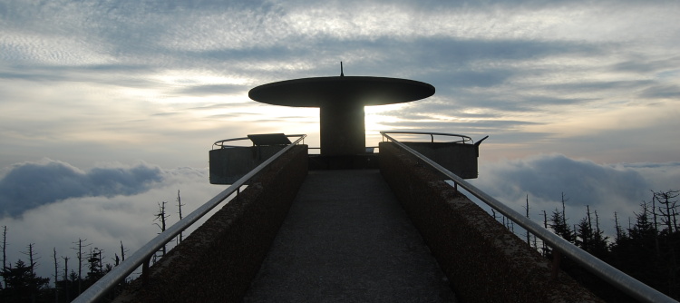 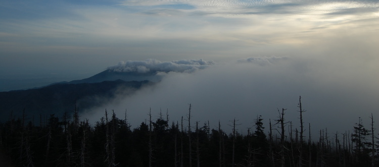 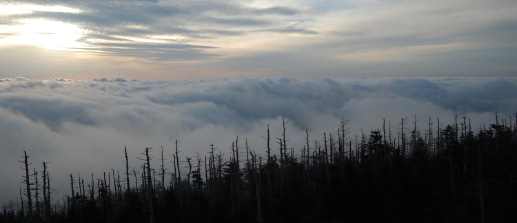 Heading back to the Newfound Gap, you immediately cross into Tennessee. 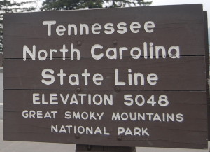 By following US 441 out of the park, you end up in Gatlinburg which immediately gives off the Niagara Falls/Las Vegas vibe. The only plus being that there were many breakfast options. The only service station I found didn't have high octane fuel available (at the most inopportune time, of course, since Tail of the Dragon was coming up - read on...). However, the Roaring Forks Motor Nature Trail just outside of town made for a pleasant scenic loop back into the park. 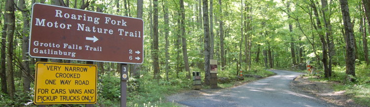 Afterward, I headed back into the park to do the Cades Cove loop. The road twists and turns as it follows creeks, with little elevation change. 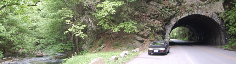 |
|
| 2453km 12h15 |
Begin Cades Cove Loop, Great Smoky Mountains NP, TN |
|
Cades Cove is a valley surrounded by the Smokies. Although its residents are long gone, many churches and homesteads continue to stand and are worth a visit. The loop is paved, but single-lane and one-way only. So you can surely imagine what happens when people spot one or more of these: 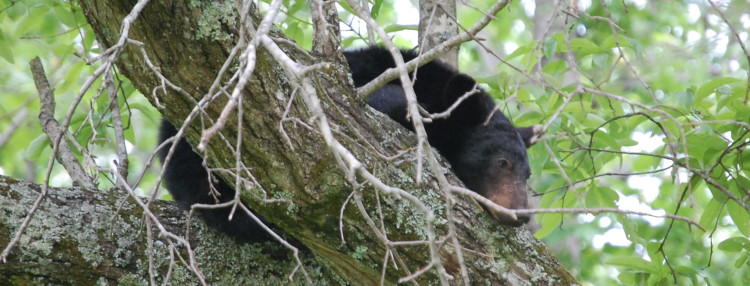 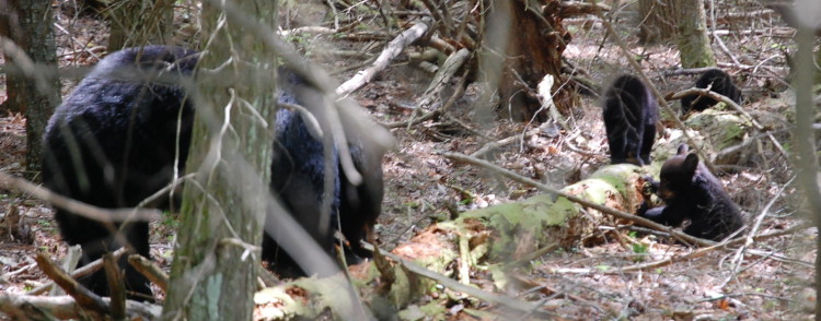 Basically, people just stop their vehicles in the middle of the road completely oblivious to the notion of what happens to a one-way loop when it gets blocked. I can't imagine the insanity that this would cause during the peak Summer months which see the highest traffic! There's just something ironic about watching wild bears in their element while a line of dozens and dozens of cars and motorcycles stand at idle, dumping burned hydrocarbons into the air. The honks and the choppers opening their throttles just adds so much to the experience. Please everyone, just move far enough over so that others can get by, and shut your engine off when you're not going anywhere. The bears are so relaxed despite the commotion, it's doubtful that you'll miss them even if you don't stop right away. To finish on a positive note however, what great luck to see two mommies and five babies in just over an hour! My intention was to leave Cades Cove on Parson's Branch Road, a one-way gravel unimproved road that gives out onto the Tail of the Dragon. However, I was greeted with a closed gate. 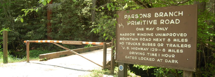 Heading back to the visitor centre, I was informed that the road had suffered flood damage and was not yet repaired. I was very disappointed that the road was closed and moreso that no attempt had been made to spare drivers the slow round trip to discover this themselves (everywhere else detours and closures had been very, very well indicated). But in the end, it wasn't a huge problem. I got to follow a similar road out of the Cove which would also eventually lead my to the Tail of the Dragon via the Foothills Parkway. |
|
| 2474km 14h30 |
Begin Rich Mountain Primitive Road |
|
I had Rich Mountain Road all to myself, and it was a fun, slow drive. In a few places I took care to keep my oil pan out of danger, but the road is very passable when reasonably dry (might be a different story after heavy rains). 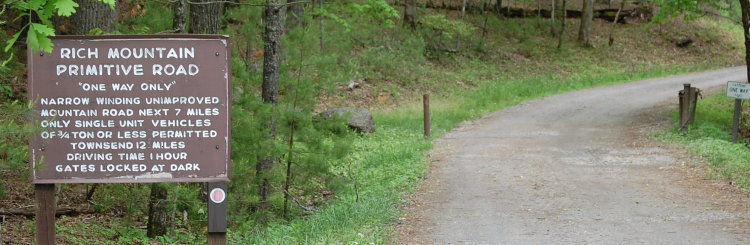
|
|
| 2527km 16h00 |
Begin Tail of the Dragon, Tennessee side |
|
The Foothills Parkway tees into US 129 which is known as the Tail of the Dragon as it crosses the Smokies into North Carolina (see www.tailofthedragon.com for details). It is touted as "the" motorcycle and sports car road in America in large part due to the fact that it packs 318 curves into 11 miles. I can see a strong argument for this case. The road is smooth, the curves are tight and tightly spaced and even if you manage to average more than the posted 30mph, there aren't many straightaways to get busted on (and the webpage even suggests where these are). The important thing to consider is that this is an open public road, however many drivers use it to really enjoy themselves. It is absolutely essential to stay on your side of the double yellow line and maintain absolute control. If I understand correctly, some of the motorcyclists run in packs led by cars that flash oncoming traffic to alert them. Safety is obviously a big concern since the number of accidents and fatalities is high. While I don't have any photos from Tail of the Dragon since I was too busy finding the Levin's grip limit, chances are you'll be photographed and find the pictures available for order on the internet through www.killboy.com where apparently the Levin was unique enough to earn a blog photo entitled "Levin". Thanks Killboy! 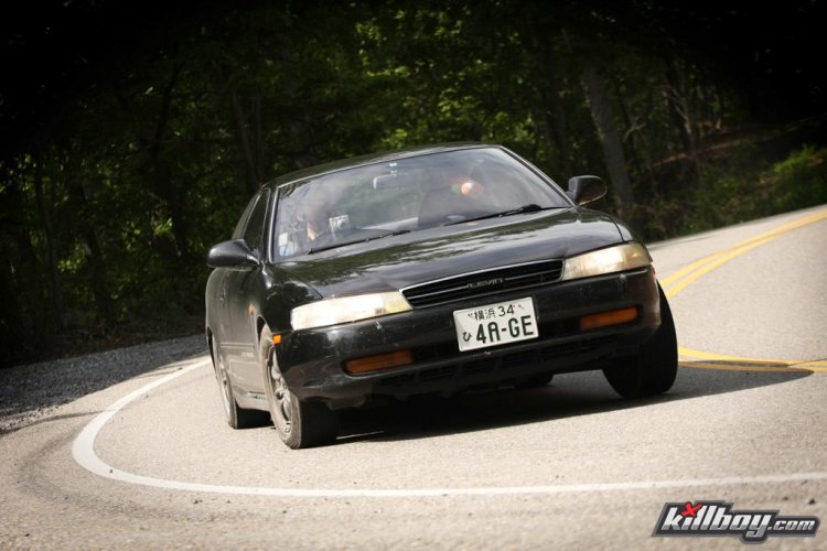 I do however have some video, click to watch. Knowing that I'd still want functioning brakes for the remaining 5000km of my trip, I didn't push the Levin to its limits, although in some curves, it was close. The grinding you hear on some of the curves towards the end of the video is the mag flexing enough to come in contact with the brake caliper. I never experienced that lapping this car, and US 129 is an open public road!
|
|
| 2593km 17h30 |
Begin Cherohala Skyway, North Carolina side |
|
The Cherohala Skyway earns the distinction of being North Carolina's most expensive road. And when you realise that there are virtually no homes, businesses or industries along its length, you wonder if the motorcyclists lobbied for its construction to create a wonderful loop with the Dragon? While the Dragon was all second gear, Cherohala was mostly third gear with lots of great sweeping curves. The speed limit is upped to 72km/h as well. 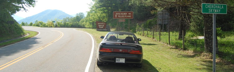 On top of the world, all alone save for the occasional motorcycle. In passing, what a fun, versatile car to drive! Too bad it was running 89 octane instead of 93 for this part of the trip... 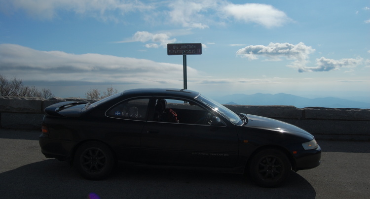 |
|
| 2662km 19h00 |
Arrive in Tellico Plains, TN |
|
The Cherohala Skyway ends in Tellico Plains. Conveniently, there's a very clean and modern KOA campground right there, which is where I spent the night. 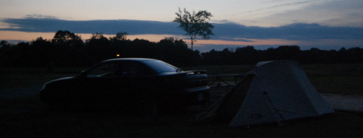 Driving Summary: 337km over about 13 hours |
|