A Cartographical History of Griffintown
(1760 to 1859) |
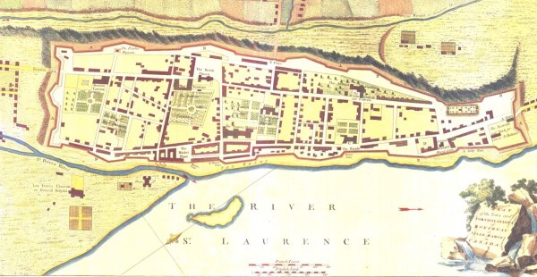
| Montréal in 1758 |
 |
|
This map predates Griffintown by about 50 years. It also predates the fall of the French colony to the British. The area that will become Griffintown is located at the bottom-left of the map. The western city wall is present day McGill Street, which will become the eastern boundary of Griffintown. The Recolets Gate is near present day Notre-Dame Street, which will become the northern boundary of Griffintown. The St-Pierre River will disappear over the next century. A few settlements already exist outside the city walls in present day Griffintown.
|
| Montréal in 1823 |
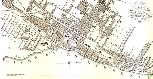 |
Griffintown clearly appears on this 1823 map. The "suburb" was surveyed in 1804 by Louis Charland, commissioned by Mary Griffin. The street grid is mostly intact today, with many street names changed. East-West examples:
- St-Maurice
- William
- Wellington
As for the North-South streets, the easternmost examples all exist today under the original names (Ann to Grey Nunn's). West of Ann, the present day steet names have changed.
|
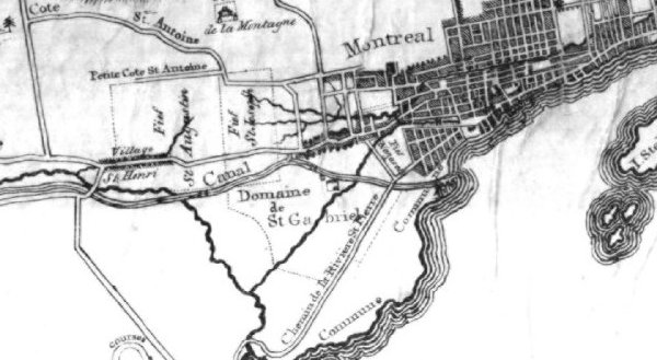
| Montréal in 1834, including westward expansion |
 |
|
The Lachine Canal, officially opened in 1825, appears on this 1834 map. Wellington Street becomes Chemin de la Rivière St-Pierre to the West of the canal. The area around the St-Pierre River is known as Domaine St-Gabriel, hence the name of St-Gabriel Street which will become present day Ottawa Street. On this map, none of the North-South streets in Griffintown cross the St-Pierre River.
|
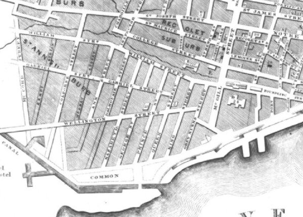
| Griffintown in 1843 |
 |
|
Colborne Street (present day Peel), McCord Street (present day Montagne) and Inspector Street appear on this map. Both Colborne and Inspector cross the St-Pierre River. Notice that Chaboillez Square, which is the intersection of Chaboillez, St-Joseph and St-Maurice, coincides with the meeting of two streams. Severe springtime flooding of this square and surrounding area was common. The features of the Lachine Canal, including basins, are clearly visible. The Collège de Montréal occupies the land between College and William streets.
|
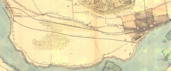
| Canal and Railroad to Lachine in 1851 |
 |
|
This map marks the appearance of the Montréal and Lachine Railroad which began operations in 1847. The Montréal terminus was located just off of Chaboillez Square. The completion of both the Lachine Canal and the Montréal and Lachine Railroad open up the hinterland behind the Lachine Rapids, and increase the importance of the city as a port. These two transportation corridors will roughly define the boundaries of Griffintown.
|
| Griffintown in 1859 |
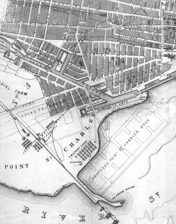 |
1859 marked the opening of the Victoria Bridge, then the longest in the world. The bridge provides the first fixed-link from the Island of Montréal to the mainland, enabling railroad connections with the ice-free seaport of Portland, Maine. The railroad, bridge and its approach are all clearly visible. Additional basins appear on the Lachine Canal. St. Ann's Parish is also visible, completed in 1854 on the triangle of Basin and Mountain (renamed from McCord) Streets. Griffintown streets which appear and exist to this day are the following:
- Common (de la Commune)
- Murray
- Eleanor
- Basin
- Olier
- Seminary (du Séminaire)
- Barré
- St-Thomas
- Aqueduct
- Guy
- Richmond
- des Seigneurs
- Canning
The St-Gabriel Street Church, New City Gas Works and St-Stephen's Church are indicated near the intersections of St-Gabriel Street with Ann and Dalhousie. The Emigrant Sheds housed immigrants fleeing the famine in Ireland.
|